|
|
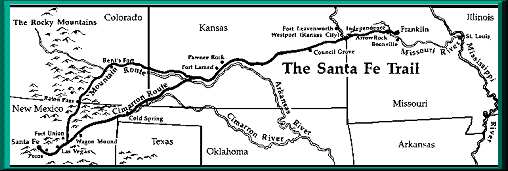
![]() To view a larger map of the entire Santa Fe Trail click here! http://www.santafetrailscenicandhistoricbyway.org/sftrailbig.gif
To view a larger map of the entire Santa Fe Trail click here! http://www.santafetrailscenicandhistoricbyway.org/sftrailbig.gif
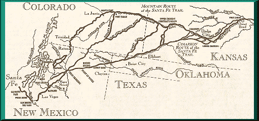
![]() Santa Fe Trail Timeline & Maps-
Santa Fe Trail Timeline & Maps-
![]() Cartographic Map of Colorado-
Cartographic Map of Colorado-
![]() Colorado Map Index-
Colorado Map Index-
![]() Colorado County Evolution-
Colorado County Evolution-
![]() 1895 Colorado Atlas-
1895 Colorado Atlas-
![]() The USGenWeb Archives Digital Map Library -Colorado State Maps-
The USGenWeb Archives Digital Map Library -Colorado State Maps-
![]() 1882 Panoramic Map of Trinidad -
1882 Panoramic Map of Trinidad -
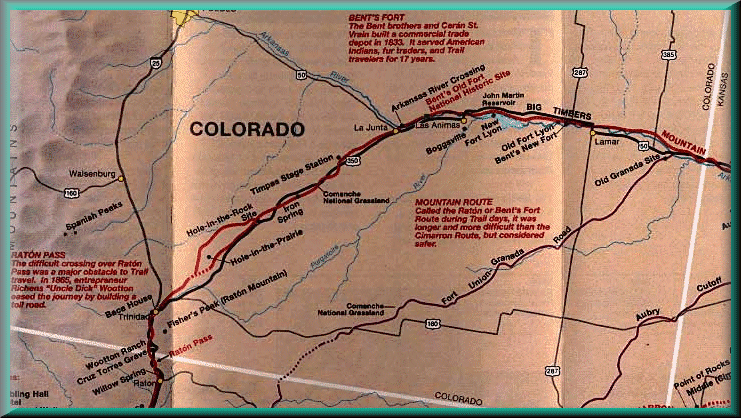
![]() The Mountain Branch of the Santa Fe Trail Scenic and Historic Byway-
Print a map of our Byway! Click on the link and print http://www.santafetrailscenicandhistoricbyway.org/map2.gif
The Mountain Branch of the Santa Fe Trail Scenic and Historic Byway-
Print a map of our Byway! Click on the link and print http://www.santafetrailscenicandhistoricbyway.org/map2.gif
Site Map |
La Junta Sites |
Lamar Sites |
Trinidad Sites |
Byway Museums |
Byway Events |
Byway Links |
